
Moorabbin, Vic – AvSoft Australia, the developers of AvPlan EFB, have today announced the launch of ok2fly. Ok2fly is a new website for remote piloted aircraft systems which will tell you if you and your drone are ok2fly.
Ok2fly is only app for remote pilots that accurately depicts all operational requirements, no matter the time of day, the type of operation or changes in airspace. Ok2fly is fully approved and integrated into the CASA RPAS platform to ensure you have the most up-to-date information at your fingertips.
Ok2fly developer Peter Derrick says, “After CASA decided not to proceed with the development of a replacement for the now discontinued Can I Fly There app, and because we were already delivering planning solutions to professional drone pilots, we decided that we could easily fill the gap in the market.
“Given our experience with professional drone, general aviation and commercial pilots we knew that they are very detail oriented,” he continues. ”Therefore, for them to want to use the app, the app would need to provide the user with the information they require to fly their drones as safely as possible.”
As a CASA Part 175 certified data provider AvSoft were uniquely placed to provide the information needed to fill the basic data requirements of the app, but based on our electronic flight bag and recent digital mapping efforts the company was also able to provide a more comprehensive tool for drone pilots to use.
This includes :
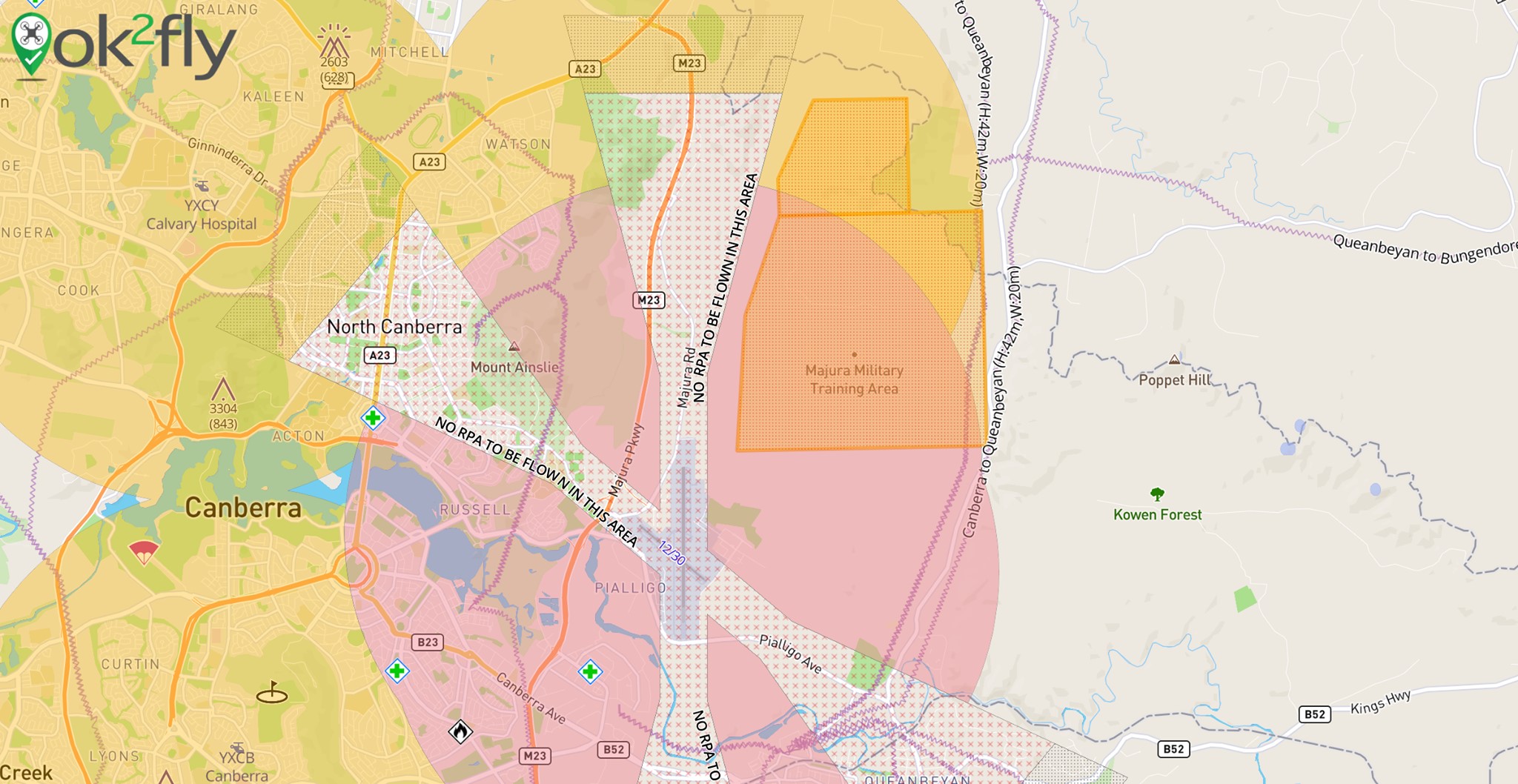
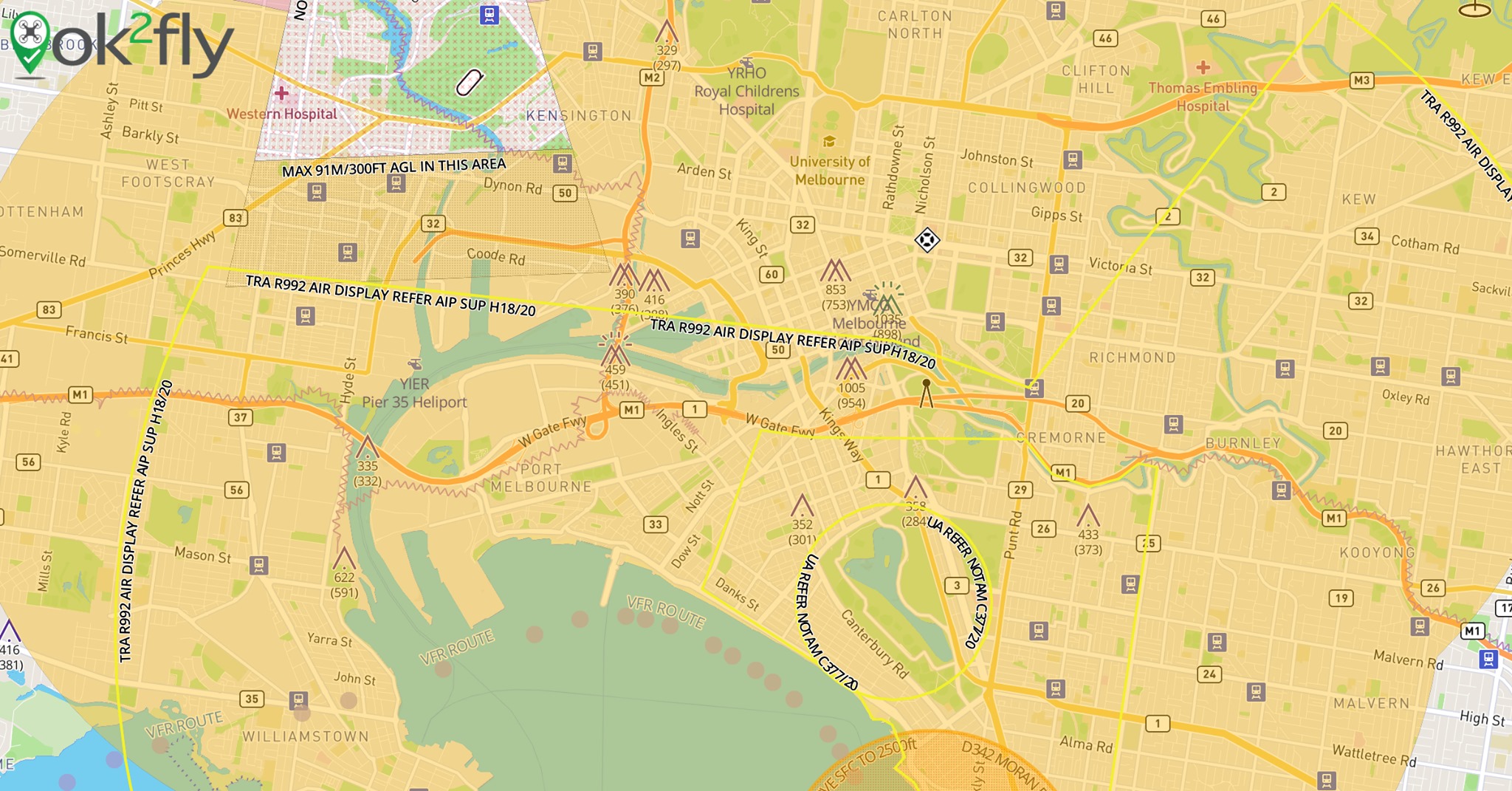
- real-time activation of restriction and danger areas
- automatic visualisation of NOTAMs effecting drone operation
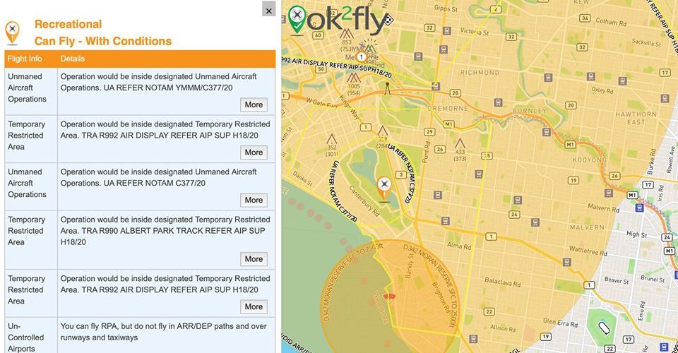
- drill down on restricted, danger and visual NOTAMs
- extended radius review of the drone flight area
- detailed reporting beyond a basic yes I can or no I can’t fly
- reduced clutter by minimising the overlap of objects
- making sure that spatial rules effecting whether a drone can be flown at a location are clearly depicted
- automatically providing links to supplemental decision-making information
“There’s actually a lot more to come,” says Peter. “Users have been providing great feedback to us, so there are some new items in the enhancement list thanks to our users.”
In the future, ok2fly will incude:
- high resolution terrain map
- radio frequency data
- additional restriction/danger information
- additional airspace display options
- continued refinement of existing functionality
- and, of course, mobile versions
For more information visit https://ok2fly.com.au